
Ecopark & Ritigala Reserve
Ecopark Habarana (Dept. of Forest Conservation)
- Area: 231 km2,
- Status: Established 02 May 2005.
- Main entrance: 2 km north of Habarana town off the Colombo-Trincomalle road (A6).
- Travel time from PRS (monkey camp): 60 min
Geography and habitat: Flat and undulating terrain with the Habarana mountain ridge running north-south through its center. It forms part of Huruluweva catchement area. Dry evergreen forest prevails. The grassy areas among the hills is preferred habitat during the rainy season when the lakeshore grasslands surrounding other parks are submerged.
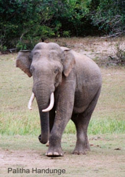
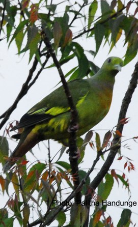
Wildlife: Preferred habitat for elephants during rainy season (October to May). Other dry zone animals are present.
 Ritigala Strict Nature Reserve
- Area: about 18 km2, and 766 m elevation to the summit.
- Status: Strict Nature Reserve.
- Main entrance: Off the Habarana to Anuradhapura road (A11).
- Travel from PRS (monkey camp): 90 min
Geography and habitat: This is an isolated hill that, at 766 m, is the tallest in the northern dry zone. The peak is often shrouded in clouds giving rise to a climate and flora with more similarities to the hill zone than the lowland dry zone. The water flowing off Ritigala feeds streams leading to the Nachchiduwa and Huruluweva reservoirs. Streams originating on this hill flow long distances to the east coast north of Trincomalee and to the north-west coast near Mannar.
History and culture: In the 4th Century BC, king Pandukabhaya spent his youth at Ritigala, and this was the key religious center after the advent of Buddhism. There are about 60 rock caves and monasteries that served as centers for meditation and learning in bygone eras. Ritigala is also know as Ariththa Pabbatha.
Wildlife: Although the climate varies greatly with altitude, the wildlife is typical of the lowland dry zone forests.